This report summarises the results of geospatial mapping of the fishing effort from surface gears and other gears (Chagos Archipelago only) as published by the IOTC for the period 2016-2020. This analysis focused on the areas and periods of fishing operations of flag-states operating within the Western Indian Ocean, together with AIS usage and transmission relative to the High Risk Area (HRA) for piracy. The key rationale behind the presented analysis are concerns as raised by the Blue Marine Foundation, and others, regarding reported catch-effort, areas of operation, and transparency/visibility of fishing operations in the western Indian Ocean. Catch and effort data was extracted from available datasets in the Indian Ocean and converted into georeferenced 1°x1° and 5°x5° data grid cells. Data cells were grouped relative to cell position within Exclusive Economic Zones (EEZs) for coastal-states and a disputed maritime territory. Annual effort and catch is reported in table form for each coastal-state, along with months per annum where catch and effort were reported.

Impact Report 2025
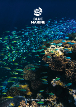
Blue Marine drives global ocean recovery by advancing marine protection, restoring habitats, influencing policy, supporting communities and tackling overfishing, with measurable impact across 29 countries and 446,620 sq km of ocean.
27 February 2026